


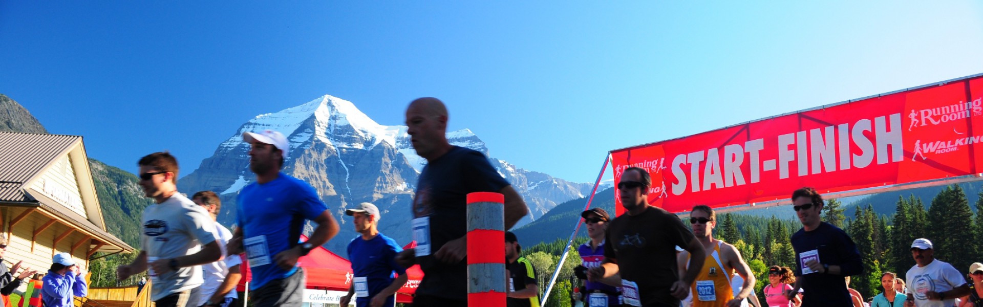
Runners start at the base of Mount Robson and run up the Berg Lake trail to the back of the mountain where glacial ice floats in the turquoise blue water of Berg Lake.
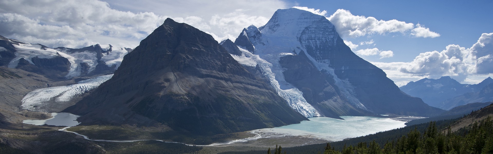
Looking down on Berg Lake and the back of Mount Robson. Ultra marathoners run along the edge of the lake to the Great Divide and BC/Alberta border at Robson Pass, and then return to the start/finish.
The Mount Robson Ultra Marathon is back for 2025! After a few years of being put on hold due to Covid and the trail flooding of 2021, we are now reinstating this popular run on the Berg Lake Trail.
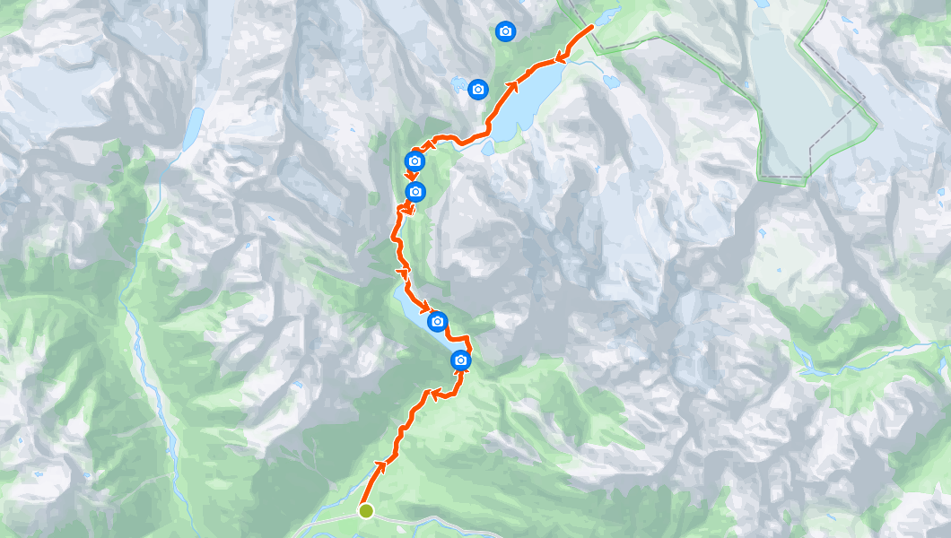
The 2025 Mount Robson Ultra Marathon will be an “out-and-back” run on the world famous Berg Lake Trail. The route passes through several different environmental zones and has its turn-around point just past the the shores of magnificent Berg Lake, truly making this marathon a one-of-a-kind experience. The route was extended in 2015, to be 50 km long, an Ultra Marathon.
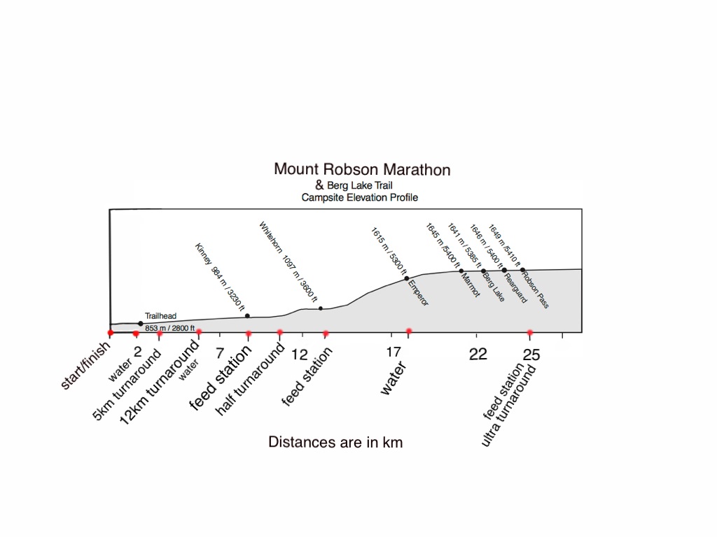
The ultra marathon has an elevation gain of 825m/2,700ft over the 25km to the turn-around point. The section from Whitehorn Campground to Emporer Falls Campground climbs steeply and almost continuously through the Valley of a Thousand Falls for about 5km, with an elevation gain of about 500m/1650ft. Most runners will find themselves walking much of this section.
The Berg Lake Trail is the most heavily used backcountry trail in the Canadian Rockies, with over 2,000 overnight users each year. The trail is very well maintained and recently upgraded. It is mostly hardpacked ground with very few exposed roots or protruding rocks.
Online registration for the Mount Robson Ultra, and all other events, will open on May 1st. A registration link will be posted on our website at that time.
Marathon Route Overview
Total distance: 50km
Total elevation gain: 1300m (825m difference from start to turnaround, with some smaller ups and downs along the way)
Start at the Mount Robson Welcome Centre, turnaround at Robson Pass campground.
*note: GPS data will read greater elevation gains than what is listed below for each section, as the descriptions below state the increase in elevation from starting point, but do not take into account any little ups and downs that are a part of the trail contour. The total elevation gain for the race, including ups and downs of the trail, is about 1300m, but there is likely to be a large variation in individual GPS readings.
- start at Mount Robson Welcome Centre
- 2km flat paved road to Berg Lake trailhead, 15m of elevation gain in 2km.
- aid station located at the trailhead at 2km
- mostly gradual climb along Robson River through cedar rain forest to Kinney Lake picnic area (aid station, 160m elevation gain, 6km)
- short up and down and then flat along the shore of Kinney Lake to Kinney Lake campground (aid station, no net elevation gain, 9km)
- gentle incline through coniferous forest onto the gravel flats of Robson River where the half-marathon turns around.
- moderately steep incline to Whitehorn Campground (aid station, 130m elevation gain, 13km). This is the location of the first cut-off for the Ultra Marathon. Runners will need to pass by this aid station by 9:45am. This allows 1hour and 45 minutes to cover the first 13km.
- the hard part – up Valley of a Thousand Falls to Emperor Falls Campground (aid station, 500m elevation gain over 5km to the 18km point). The top of Emperor Falls hill is the location of the second cut-off. Runners will need to pass through this point by 10:45 am. This gives 2hours and 45 minutes to cover the first 18km of the course which includes all of the major climbs.
- gradual climb to the shores of Berg Lake and then along the lake to Hargreaves Shelter, then continuing along flat trail about 2km past the shelter to the turn-around and aid station at Robson Pass. (aid-station, 15m elevation gain, 25km)
- Aid stations located at Kinney Lake, Whitehorn and Robson Pass will be supplied with: water, Gatorade, cut up energy bars, and energy gels. The Finish line aid station will have cut up fruit, cookies, chips, Gatorade and water. All other aid stations will have water and Gatorade. We are a cupless race, and runners will need to be self sufficient and bring their own cup or bottle with them.
Cut-Offs
- Cut-offs will occur at 9:45 am at Whitehorn Campground (13km in to the race), and at 10:45 am at the top of Emperor Falls hill (18km in to the race). Runners reaching these cut-off points after the indicated time will be turned around and unable to complete the full ultra marathon.
Click on the link to view and download the PDF map of the Mount Robson Ultra: MRM2015_map_profile
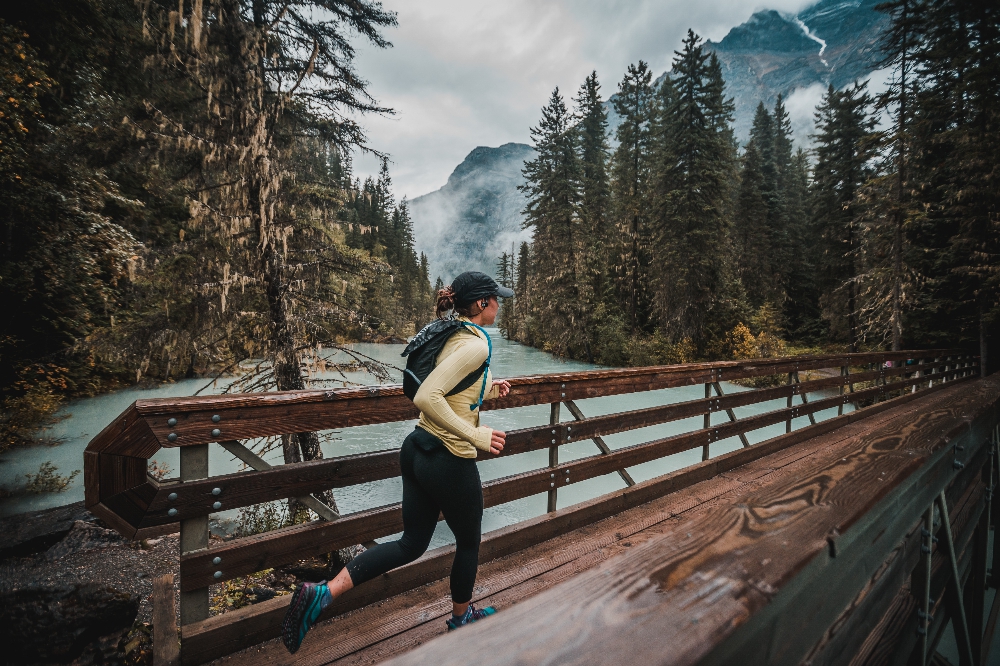
Runner makes her way across the Kinney Lake bridge
Photo: Boosted Imagery